More Information
Courtesy of Dang D Thanh.
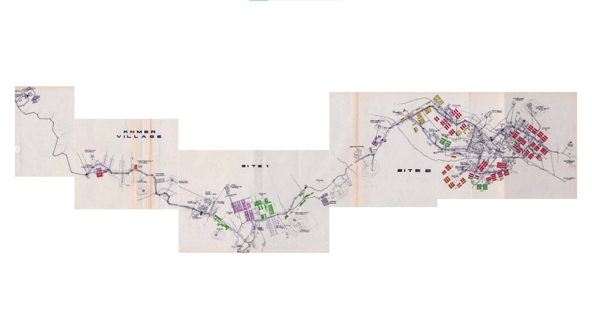
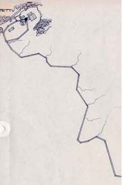
This map is a part of a technical document that I helped prepare when I was working in Galang Technical Office. The map is organized so that the main road is seen running continuously from harbor (jetty) through the camp and ends at Galang Site II.
The jetty
The first and last image one would have when arrives and leaves Galang. it was a burning wish for me, and for most people who live here, to leave this place behind, but everybody leaves this island carrying along heavy hearts and bitter souls.
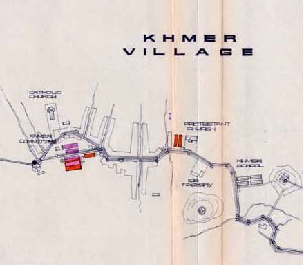
Khmer village
located between site 1 and jetty, khmer village houses cambodians who do not have the luxury option of going to a third country. most of them have to go back to their country, except for a few rare lucky cases.
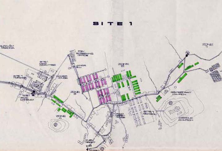
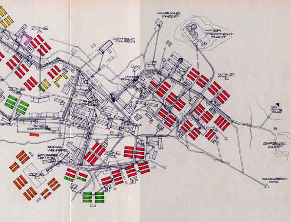
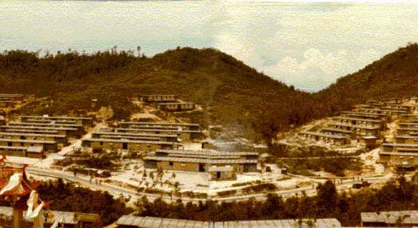
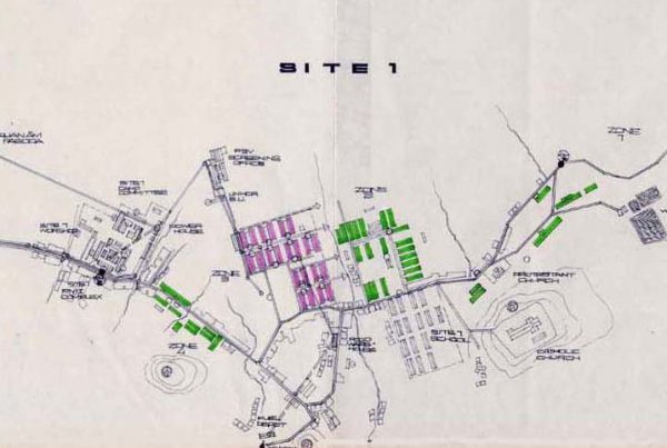
Galang site 1
consists of 4 zones. zone 3 was designed to house asylumseekers, those who have not been granted refugee status, and waited for screening process. when the population got bigger, the camp added zone 1, 2 and 4 as well as a school, catholic church, and hospital to provide service for the community.
Galang 3
everyone in galang knows this place where the unfortunates were buried. It is sad to see people risked evrything and ended up laying here without someone to care fortheir resting place.
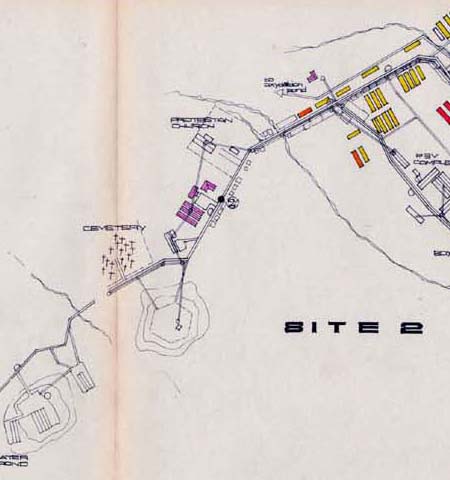
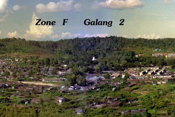
Galang site 2
this is galang capital, where unhcr and camp commander located their offices which ran the camp. also galang 2 provides better housing and activities than other sites since it originally built for refugees who were waiting for resettlement. living in site 2 considered upper class among galangers.
© 2026 Vietnamese Heritage Museum. A 501(c)(3) Non-Profit Organization, EIN 82-2141214. All Rights Reserved.